Space Scientists Take Advantage of Pandemic Travel Drop
Although the COVID-19 pandemic caused new challenges for both students and researchers, it also triggered some unique research opportunities.
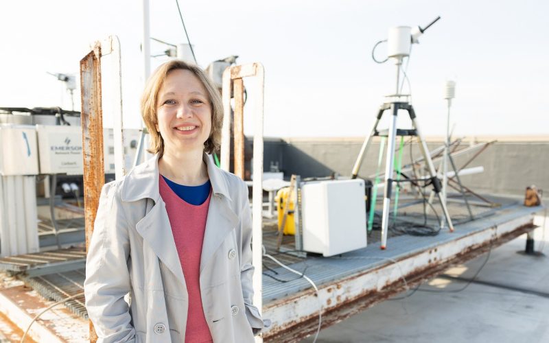
When most travel ceased early in the pandemic, Elena Spinei Lind, an assistant professor of ECE, went to the airport. In a project funded by NASA, Lind and her collaborators at Georgia Tech studied how pollution near airports changed when travel restrictions limited air traffic.
Machines that use a combustion engine, including airplanes and vehicles, leave nitrogen dioxide (NO2) emissions in their wake. NO2 is a highly reactive gas that can cause respiratory diseases, participates in ozone formation, and as a result contribute to air pollution. “As electric vehicles become more common,” says Lind, “airports might become the biggest source of pollution in a city.”
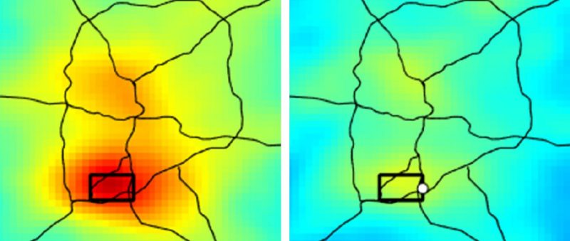
Taking measurements around the Atlanta and Baltimore airports—both from space and at ground level—Lind hopes to understand how these emissions are generated and spread through the atmosphere.
Satellite measurements, taken once daily from a satellite in asynchronous orbit, can measure the total NO2 in a column above the airport, but can’t indicate how high the pollution is at the ground. Most N02 is emitted at ground level, explains Lind, then spreads both horizontally and vertically. But airports might show something different, she notes, since so much of their pollution is generated above ground level.
Lind’s team took similar measurements from the ground to get a more complete picture. “The ground measurements tell us how the NO2 is spreading out,” she says. Their instruments included ultraviolet-visible spectrometer systems and sky camera, measuring both NO2, formaldehyde and sky cloud cover.
Although the limited travel of the pandemic showed significant changes in the NO2 near airports and gave Lind a lot of useful data, she notes that it’s still difficult to tell what actually causes the pollution she’s seeing. “The hardest part is decoupling where the emissions are really coming from,” she says. “On-road traffic bounced back much faster than airplanes. Untangling all this is very complex.”
Lind and her team continue to process the huge amounts of data they collected. The instruments measure the gas absorption by solar photons traveling through the earth atmosphere, and radiative transfer models describe the path those photons traveled, Lind explains. “We have to understand the effects of aerosols and clouds on photon scattering to fully interpret the measurements.” Only then can they derive the NO2 vertical distribution and determine where the NO2 really is at the airports and how the pandemic changed its distribution.